")
")
")
Located in south-eastern Europe, Albania is at the crossroads of three major cultural areas:
- Greece and the Aegean world on the one hand,
- the Balkans and Central Europe on the other,
- and finally the Italian peninsula.
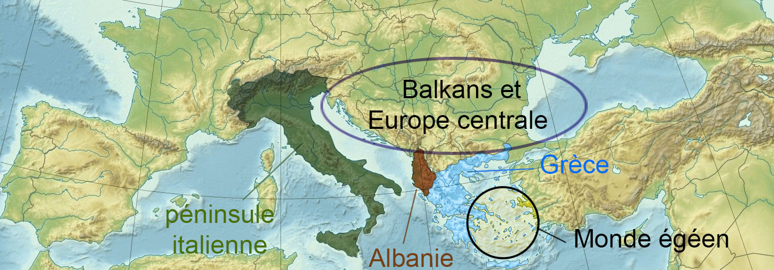
It is this privileged position that is, in large part, the reason for its archaeological and historical interest.
Albania is a small country with a surface area of 29,000 km2, with a very uneven relief, where mountains, some of which exceed 2000 m in altitude, occupy most of the space.
Albania is therefore located to the northwest of Greece, with which it shares a border (to the south). This border divides the ancient province of Epirus, which is now divided between the two countries.
- To the east and north, Albania is bordered by the former Yugoslav republics: Macedonia, Kosovo (Serbia) and Montenegro;
- To the west it is bordered by the Adriatic Sea, which has never been a barrier, not in ancient times and not today, but rather a bridge, the Otranto Channel, which separates the Albanian coast from the Italian coast, measuring only 70 km wide.
Albania is a country where plains are rare and small: in the west the coastal plain, which extends from Shkodra (in the north) to Vlora (in the south), is no more than 30 km wide; outside this narrow coastal strip, the plains are reduced to a few small inland basins surrounded by mountains, notably the Korçë basin in the southeast. Albania is thus divided into a series of micro-regions, between which communication is often difficult.